

AGRO Inspector app for iPhone and iPad
Developer: TMG Group, s.r.o.
First release : 05 Oct 2017
App size: 6.24 Mb
AGRO Inspector analyzes multispectral and RGB data from drones and aircraft captured images. It gives you access to your data anytime, anywhere from your device. Recommended for drone owners, farmers and insurance companies for recognising potential damage to crops (like wheat, corn, oil seed rape).
The mobile application comes from a desktop solution that is available for you and your clients, too. For more information about technical specification and workflow, please send request to [email protected].
Features:
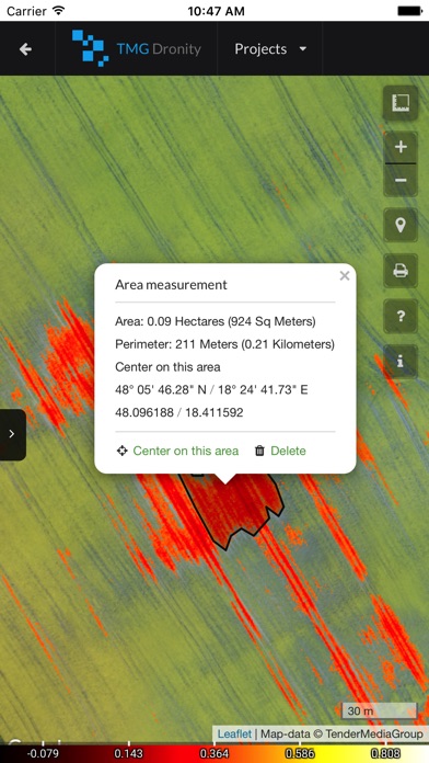
- Fast area and distance measuring
- 1 cm/pixel ORTHOMOSAIC, DSM, DTM
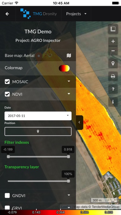
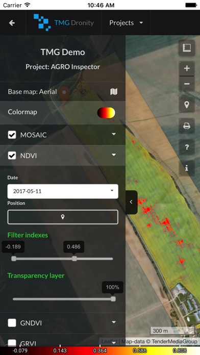
- index maps : NDVI, NDRE, GNDVI, GRVI
- Filtering different indices value in layers
- Set transparency layers
- Onscreen review of existing data
- Multiple coordinate formats
- Smart Marker Mode for super accurate pin placement
- Markers can contain different types of files (archives, images, documents)
- Base map : Satellite, Terrain, Roadmap and Hybrid modes
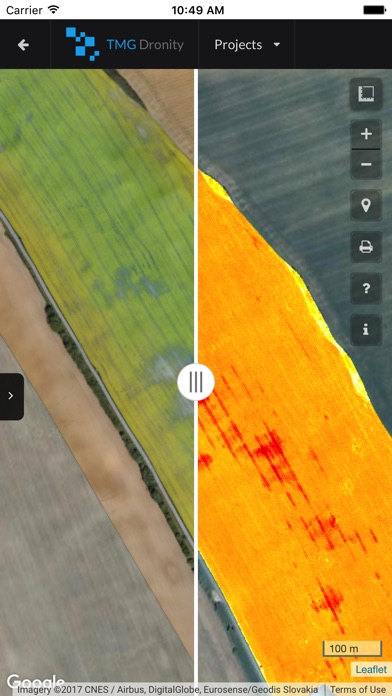
- Comparing layers and monitoring of changes in time
- ability to share your maps
Technical Features:
- No ads
- Minimum permission